At first sight, Wray Castle appears to be an impressive defensive structure, complete with battlements, turrets, and even balistraria (slits from which archers could fire arrows). It stands in a prominent position on Watbarrow Point, on the western shore of Windermere, guarding the northern reaches of the lake, and the town of Ambleside. Inside the building, solid oak panels adorn the thick, seemingly impenetrable stone walls. A substantial solid oak staircase leads to the upper floors, whilst a maze of narrow corridors on the lower floors is clearly intended to give those not familiar with the layout enormous difficulty in navigating the castle's interior. In short, every aspect of the building's construction is clearly designed to offer the inhabitants a feeling of safety in a hostile environment. Or is it?
All is not as it seems. Despite the castle's rock solid appearance, in the event of a battle it would be about as much use as a chocolate teapot! It is sited in the wrong place to defend Ambleside, has never had any armaments, nor soldiers to fire them, and it's position on a headland would make it vulnerable to attacks from all sides. Luckily, no attack has ever taken place, due to the fact that Wray Castle is not actually a castle. Nor is it particularly old, certainly not old enough to have existed when battles were fought in England. It is a Victorian mock castle. The battlements are merely for show. The oak panels and staircase are not actually made of oak, but stained pine. The interior stone walls are made of plaster, with grooves cut to make it look like heavy duty stonework.
When it was built it was described by many locals as a folly of huge proportions, and was reputedly hated by one of it's owners. Which begs one simple question. How did a mock Castle go from being likened to a folly, to becoming one of the most important Victorian buildings, not only in the Lake District, but in the whole of England? And how did it achieve that position without even it's owners realising the true significance of the building in both the culture, and the history of England. To find the answer, you have to dig deep into the history of the castle and the people that have made it not only their home, but also their workplace.
The building owes its existence to the Dawson family; James, a wealthy Liverpool surgeon, and his wife Margaret, whose family were in the gin distilling business. They had originally wanted to buy a castle beside a Scottish loch, however, the cost of doing so proved prohibitive, so they came up with the idea of creating their own castle beside England's largest lake. They are reputed to have used Margaret's inheritance to buy Watbarrow Point, and build their dream retirement home.
The truth behind the funding and design of the building has been the subject of much conjecture in recent years, particularly regarding the role of James Dawson's wife, Margaret. It was thought that she had not been part of the design team, which originally consisted not of an architect, but an accountant. Margaret is reputed to have not seen the building before it was finished, and when she did finally lay eyes on it, hated it so much that she vowed never to spend a night in the place, although she later relented.
However, Margaret probably had a much greater role in the building's development than previously thought. She was, after all, providing the money, and seems to have been intent on spending as little as possible. She feared that it was such a grand plan that an architect would create a design that was unaffordable. An accountant would be more likely to keep an eye on the costs, and seek ways to reduce them, substituting cheap materials like stained pine for oak panelling in order to drastically reduce the cost.
The plan to utilise the skills of an accountant instead of an architect backfired. The accountant was simply not up to the job, due in part to his vocational training, but also his alleged alcoholism. The renowned Victorian church architect HP Horner, who had offices in Liverpool and knew the Dawsons, was brought in to complete the job. Consequently, the £60,000 they ended up paying was far more than they had originally anticipated, and well in excess of what the finished building was worth.
What is known for certain is that many locals saw through the subterfuge, with some eminent members of society calling it a folly of huge proportions. William Wordsworth, however, gave it his blessing. At that time Wordsworth was employed as “Collector of the Royal Stamp”, the tax that we know today as stamp duty. He had an office in Ambleside, and would either have visited the Dawsons to assess their land and building transactions for tax, or arranged to meet them at his office. Regardless of where they first met, Wordsworth certainly paid subsequent visits to Wray, advising James Dawson about growing a range of plants and flowers, and even helping to design the gardens. A commemorative Mulberry Tree was planted by Dawson after the death of Wordsworth in 1850.
After James Dawson’s death in 1875, the estate was inherited by his fifteen year old nephew, Edward Preston Rawnsley. In 1877 Edward's cousin, Hardwicke Rawnsley, took up the position of vicar of Wray Church, which had been built on the Wray Castle estate. It was an appointment that was to have an impact not only on those living in the area at the time, but the cultural life of the entire nation. (When Hardwicke Rawnsley died in 1920, the Times obituary notice wrote that "It is no exaggeration to say – and it is much to say of anyone – that England would be a much duller and less healthy and happy country if Rawnsley had not lived and worked.”).
In 1882, Wray Castle was let out as a summer residence to the Potter family, Rupert and Helen, and their children Helen and Walter. They attended church, and met Hardwicke Rawnsley. In keeping with societal protocols, Rawnsley and his new wife Edith were then invited to dine with the Potters, and consequently got to know the children. One curious aspect of their personalities that amused Rawnsley was the way in which the children insisted upon using their second names. Walter preferred to be called Bertram, and his sister liked to be called Beatrix. Rawnsley encouraged the young Beatrix to develop her artistic talents, and she spent the summer producing a series of very fine botanical drawings, some of which are on display at the Armitt Museum, Ambleside.
Rawnsley was an influential figure in the Lake District during the late Victorian period. Just one year after he first met Beatrix Potter he moved to St Kentigern's church at Crosthwaite, Keswick. Once there he threw himself into conservation work, and in 1895 co-founded the National Trust. Meanwhile, Beatrix Potter was forging ahead with her fledgling career, at first producing a set of watercolours for Christmas cards, then publishing her first children's book, 'The Tale of Peter Rabbit'. She and Rawnsley remained in contact with each other, and when she attempted to sell her manuscript to London publishing houses, without success, he lent assistance, persuading Frederick Warne and Sons to accept the book for publication. It was an instant success, and was followed the year after by two more. As sales of her books grew, Beatrix found a variety of uses for her increasing wealth, one of which was to donate a considerable sum of money to the fledgeling National Trust. When she married in 1913, her surname changed to Heelis, and such was her importance in the early days of the Trust that the organisation's head office in Swindon, Wiltshire is named 'Heelis' in her honour.
If you read any history of Wray Castle, and quite a few exist online, you will notice that there is very little information about the castle's ownership from the 1880's through to 1929. The building certainly seems to have reduced in both status and value during that period of time. When Sir Robert and Lady Barclay bought the property in 1929 they paid less than £5,000. They purchased it with the express intention of presenting it to the National Trust, which they did, having first spent a small sum of money on necessary repairs.
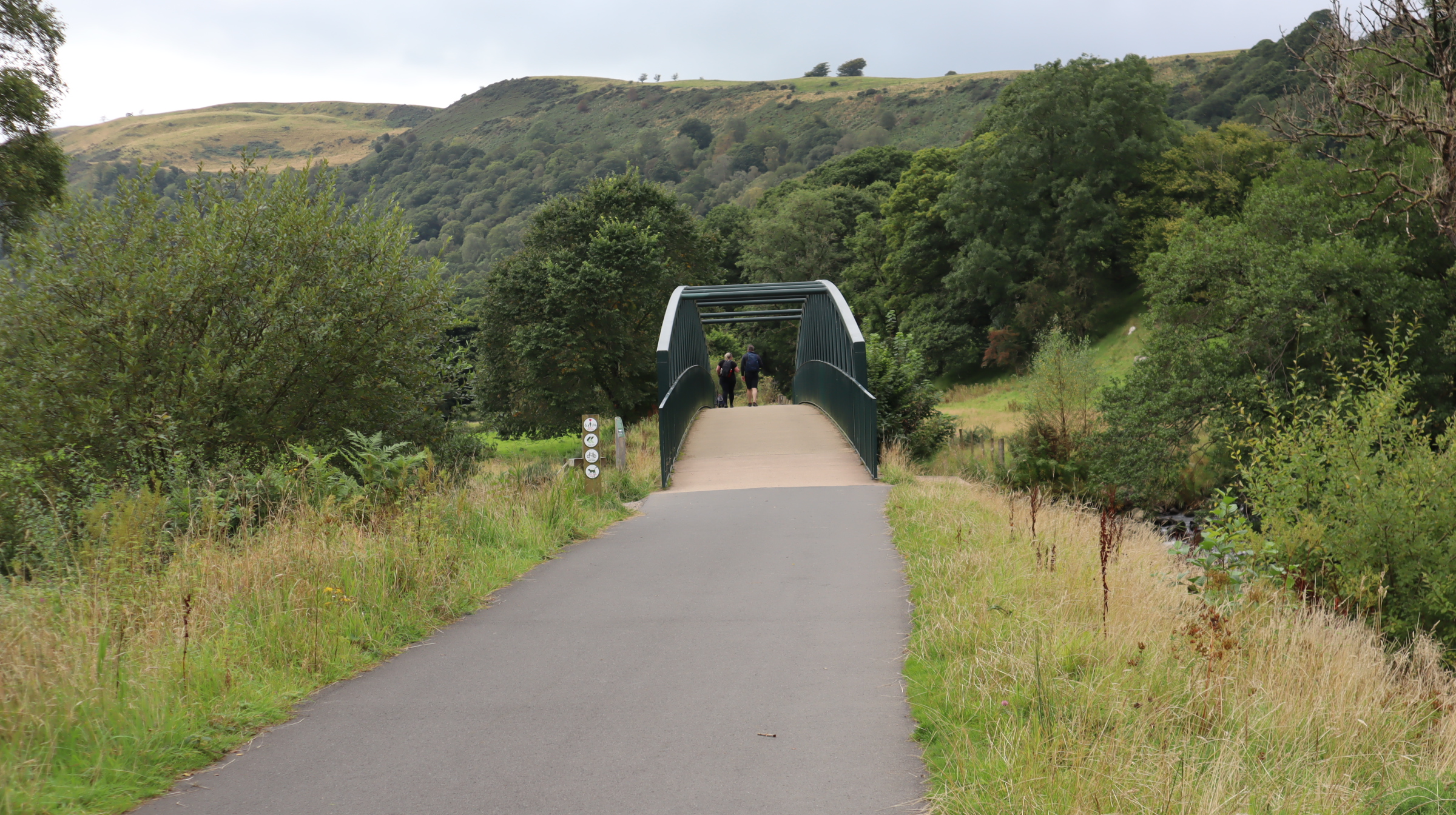
Despite the lack of documentation, it seems likely that Wray Castle was hired as summer holiday accommodation to a variety of groups and organisations, who utilised not only the building, but also the extensive grounds and lake frontage. When the National Trust took over the building in 1929 it was being used as a youth hostel. The scenic setting, well away from the hustle and bustle of every day life, was ideal for religious groups, who were seeking to provide the youth of the day with a healthy, outdoor adventure type experience, combined with the discipline of group living, and laced with a healthy dose of worship. There seem to have been no staff to help cater for the groups, instead they would be required to do their own housekeeping and catering. Such use clearly took its toll on the fabric of the building, and the revenue from summer only use would have been limited. The National Trust needed to find a solution, and in 1931 rented the building to the newly formed Freshwater Biological Association, for use as a research station.
The Freshwater Biological Association is a little known, but extremely valuable organisation. The population of the entire world needs a good, clean, water supply, and so understanding the freshwater environment is of vital importance. However, before 1929 no organisation to carry out the important research work required to truly understand the freshwater environment existed in the United Kingdom. This was a glaring omission for a country whose history was steeped in scientific advancement, and whose empire had once extended to rule almost a third of the world, including many nations where good sources of clean running water simply did not exist. A small group of scientists had been carrying out research work on the lakes and streams of Cumbria, but they had no base. When they learned of the opportunity to lease Wray Castle, on the shores of Windermere, less than a mile from Blelham Tarn and within 4 miles of Esthwaite Water, they embraced the opportunity with open arms, and The Freshwater Biological Association of the British Empire was born.
Wray Castle in 1931 was not in a good state of
repair, however, this did not deter the scientists. Their own
operation was not exactly high tech. They set up a makeshift
laboratory using home made equipment, and, nicely hidden away from
the hustle and bustle of the 1930's tourism industry, they set to
work. By 1950 their research had attracted world wide attention. The
number of staff employed continued to grow, and, having outgrown the
limited space available at the castle they managed to acquire a new
home at Ferry House, 3 miles away. Having lost it's permanent tenant,
the Castle reverted to being a youth hostel for groups of summer
campers again.
The Freshwater Biological Association had managed to maintain its operations during the war years, in fact some locals humorously suggested that it was partly responsible for the allied victory in North Africa. In the early forties the association carried out a study on the prevalence and health of the lake's perch population. They reported that it was both plentiful, and in fine fettle, so the government asked them to arrange for about 50% of the perch to be netted and sent away to be canned. Someone in high office concluded that tinned perch would be an excellent form of rations for the troops. The troops, having tasted them, did not agree!
The canned perch were sent to the 8th Army in Tripoli, but when German and Italian forces under Rommel took Tripoli, the British retreated, leaving the cans of perch behind. After the first battle of El Alamein, Rommel's Troops were in good condition, and the 8th Army was on the back foot. However, the German and Italian forces had one problem. They were running short of food supplies. They resorted to the tinned perch for sustenance, which turned out to be a bad move. The second battle of Al Alamein was a decisive victory for the 8th Army. Whilst no one could deny the courage and determination of the allied forces, those Lake District residents in the know with regards to the edible qualities of the fish, had no doubt that the tinned perch had seriously affected both the fighting strength, and morale, of the enemy force, and had therefore proven to be the ultimate secret weapon.
Wray Castle was also involved in a top secret
wartime operation, in fact, one that was so secret that, even today, no
official records of it exist. In May 1941, the former deputy Fuhrer of the
Nazi regime, Rudolph Hess, flew secretly to Scotland. His mission was
to persuade the British to negotiate peace with Germany in return for
retaining its empire. Hess feared that fighting on 2 fronts would
overwhelm the German military, and since Hitler was intent on
invading Russia, Hess believed that the only chance of success for
Germany was to keep Britain out of the war. However, things did not
go according to plan. Instead of meeting with Churchill and
negotiating a peace deal, Hess found himself being detained and
debriefed, before spending the remainder of the war in isolation in
Wales.
In the early days of his detention he was held at Buchanan Castle, Stirlingshire, which was being used as a hospital, however, it was decided to move him further south, first to the Tower of London, and then on to the wonderfully titled 'Camp Z', at Mytchett Place, on the Surrey/Hampshire border. Transferring an important prisoner such as Hess during wartime was not easy. The journey had to be as secret as possible, and due to wartime restrictions and the danger of air raids, it was decided that it would be conducted in stages.
For reasons best known to himself, Churchill chose Wray Castle as one of the staging points. It is not known whether he was aware that it was not actually a castle, and was being used by the Freshwater Biological Association as a research facility, but if he did it certainly didn't deter him. In fact, he may have seen it as an advantage, after all, who would consider that a freshwater research laboratory would ever be used as a makeshift prisoner of war camp? Consequently, at some time at the end of May 1941, a special train containing the prisoner and a contingent of over 100 guards, pulled into Windermere station. The carriage that Hess had been riding in had no windows, and he was quickly blindfolded and transferred to a car in the middle of an armed convoy for the journey to Wray. Once there, he was placed in a room on the first floor, with a view over the garden as opposed to the lake.
During his all too brief stay he complained about a number of issues. The feeling that the castle was cold, damp, and had no proper ventilation seemed to be his main gripes. In addition, he was not particularly enamoured with the food that had been provided. He actually spoke quite good English, having learned it at school, and told one of the guards that his room had the 'stench of death' about it. The guard, a hard headed Yorkshireman with little time for any nonsense, replied that his comment was a bit rich, considering that the Nazis had spread the stench of death throughout the whole of Europe.
After 3 days Hess was moved on to the next stage of his journey. He was taken back to Windermere station, put onto a special train, and headed out of the Lake District for good. His stay was never made public, nor is there any mention of it in the histories of the time. All of which might beg you to ask how I found out about it. The answer is simple. One of the guards on this secret mission was my future father in law, another hard headed Yorkshireman with little time for any nonsense. Having said that, he did agree with Hess on one subject; the smell inside the castle. Although he didn't describe it as being like the 'stench of death', he did say that it was quite unpleasant. His feeling was that it was caused by the fact that parts of the castle were used for experiments, so the smell of preservative chemicals pervaded the air. In addition, the castle was being used as a storage area for a large amount of freshwater exhibits (and their associated odour), from the Natural History Museum in London.
In the early 1950's, the castle was leased by the telecommunications department of the GPO, for use as a training base. Just after the second world war very few homes had a telephone, however, the GPO correctly anticipated a surge in the number of ordinary households that would become connected, and needed a base to train their technicians. Again, I have a family connection to the castle at this point, as one of my uncles trained as a telephone engineer after the war. He used to tell of a six month stint he undertook in what he called 'the Castle of doom beside the shores of Windermere'. His less than complimentary description was as a result of staying in the building during a cold, interminably wet and windy winter, carrying out long, boring sessions of telecommunications training. He suggested that the GPO had probably found the coldest building in the whole of England, and was eternally grateful when that part of his training period was over. It wasn't long after he left that the GPO decided that they needed larger, and better equipped premises, and by the mid fifties the castle found itself empty again.
The National Trust successfully sought another new
tenant, again one in the telecommunications field, and the building
became a training college for merchant navy radio operators, with the
official title of 'RMS Wray Castle'. 150 cadets lived at the castle
and in the local area, while studying every aspect of the use of
radio at sea. I could, of course, explain the intricacies of maritime
radiography, and it's importance in the modern world, but I'd
probably get the technicalities of the subject wrong, so instead I've
included a promotional video for the training college, made in the
1980's.
Wray Castle Ltd, the company operating the training college, relocated away from the castle in 2004, ending a 46 year stay. The company still exists and thrives today, and is still based locally, at Bridge Mills, in Kendal, from where it offers a range of services in the telecommunications field.
For the next 7 years the castle was empty in every sense of the word. Due to the wide variety of uses over its 144 year history, none of the original furniture survived, and with Wray Castle Ltd removing all of their technical and training equipment, just the shell of the building remained. The National Trust was undecided over the building's future. It did not have the same status as a stately home, and it's links with the cultural icons of the Lake District, although unique, were not really considered strong enough to warrant turning the business into a tourist attraction. After all, Wordsworth may have designed the garden, but with the exception of the mulberry tree planted after his death, little evidence of his involvement remained. As for Beatrix Potter, well, she holidayed at the castle when she was 16, before she became famous for writing her books, but as with Wordsworth there were other, more notable buildings owned by the Trust that showcased her life and work, such as Hill Top and the Beatrix Potter Gallery in Hawkshead.
Consequently the Trust decided that the most likely solution to their problem was a lease to a hotel company, after all, the building is in a fine setting, and is large enough to accommodate a reasonable number of guests without having to make an excessive amount of alterations. However, by 2011 no progress had been made in securing a lease, and the Trust decided to open Wray Castle to the public during the summer season that year. It seems that it was only then that the Trust realised the potential of the building as a visitor attraction.
At
the time of writing the grounds are open free of charge to those who
wish to browse the gardens and also gain access to the water’s
edge, whilst the building itself is open to the public for a fee
during the summer months. Daily guided tours are run, and although
the house is not fully furnished there is much of interest to see,
after all, Wray Castle does have a wonderfully unique history. It
has cultural associations with three of the most important icons of
the Lake District:-William Wordsworth, Beatrix Potter and Canon
Rawnsley, (one of the co-founders of the Castle's owners, The
National Trust). It was where Beatrix Potter and Canon Rawnsley first met, an event that arguably changed British cultural history. Without that meeting, Beatrix Potter may never have successfully published her books, and whilst Rawnsley would no doubt have co-founded the National Trust, it may not have been able to make some of it's earliest purchases but for the generosity of Beatrix Potter.
But even it's cultural impact is dwarfed by the building's unique position in scientific research and ocean safety. It is fair to say that, due to the work carried out in this building, millions of people were able to enjoy, for the very first time, clean drinking water. Consequently, many thousands of lives have been saved around the world, a process which is ongoing to this day. In addition, during the latter part of the 20th century, safety at sea was enhanced, and doubtless lives saved, due to the training work carried out in the four walls of Wray Castle.
Which is really not bad for mock Castle that was originally condemned as a folly of huge proportions.