This is a delightful walk that is off road, has no hills, no boggy bits, is suitable for all ages, is ideal for families with a buggy, or wheelchairs, and makes a lovely morning or afternoon excursion. But it also tells a story, that of the Greta Gorge and it's relationship with the railway that ran through these hills.
For those that do not know the area well, Keswick is in the northern Lake District, and Threlkeld is a village about 4 miles to the east of Keswick, close to the main A66 road that connects Keswick with Penrith and the M6 motorway. For a little over 100 years a railway ran through the Greta Gorge, part of the 31 mile route between Penrith and the West Cumbrian town of Cockermouth. It opened officially in 1865, but mineral and coal trains, plus a special train for the Keswick agricultural show, ran before the the official opening, in 1864. The line carried mainly goods traffic at first, but the Penrith to Keswick section soon became popular with tourists, and until the second world war the railway thrived.
The Keswick to Cockermouth section closed in the mid sixties, mainly due to a man named Beeching and a lack of passengers. But the Keswick to Penrith section remained open until March 1972, which demonstrated British Railways attitude to railways frequented by tourists. It was kept open in the winter, when there were few tourists, and then closed a month before Easter! The track was lifted, and before long the longest tunnel on the line was filled in, of which more later.
The best way to walk the line is from Threlkeld to Keswick. This is because, although the route is gernerally level, Threlkeld is at a higher elevation than Keswick, so for most of the route you will be going gently downhill. Getting to Threlkeld is easy enough, the X4 or X5 bus from Keswick to Penrith stops in Threlkeld. All you need do is walk through the village to the junction with the A66 and continue along the sidewalk until you reach the start of the walk. (see map picture below).

Alternatively, you could do a circular walking route from Keswick, either via Castlerigg Stone Circle, or Brundholme Road. You could even link the walk in with a visit to the summit of Latrigg to make a complete day out.
You could also cycle. The trail is part of the C2C route linking the West Cumbrian Coast with the North East Coast. Cycle hire is available in Keswick, and those of a certain age may be pleased to hear that electric cycle hire is also available, from a store close to Booths supermarket and Keswick bus station.

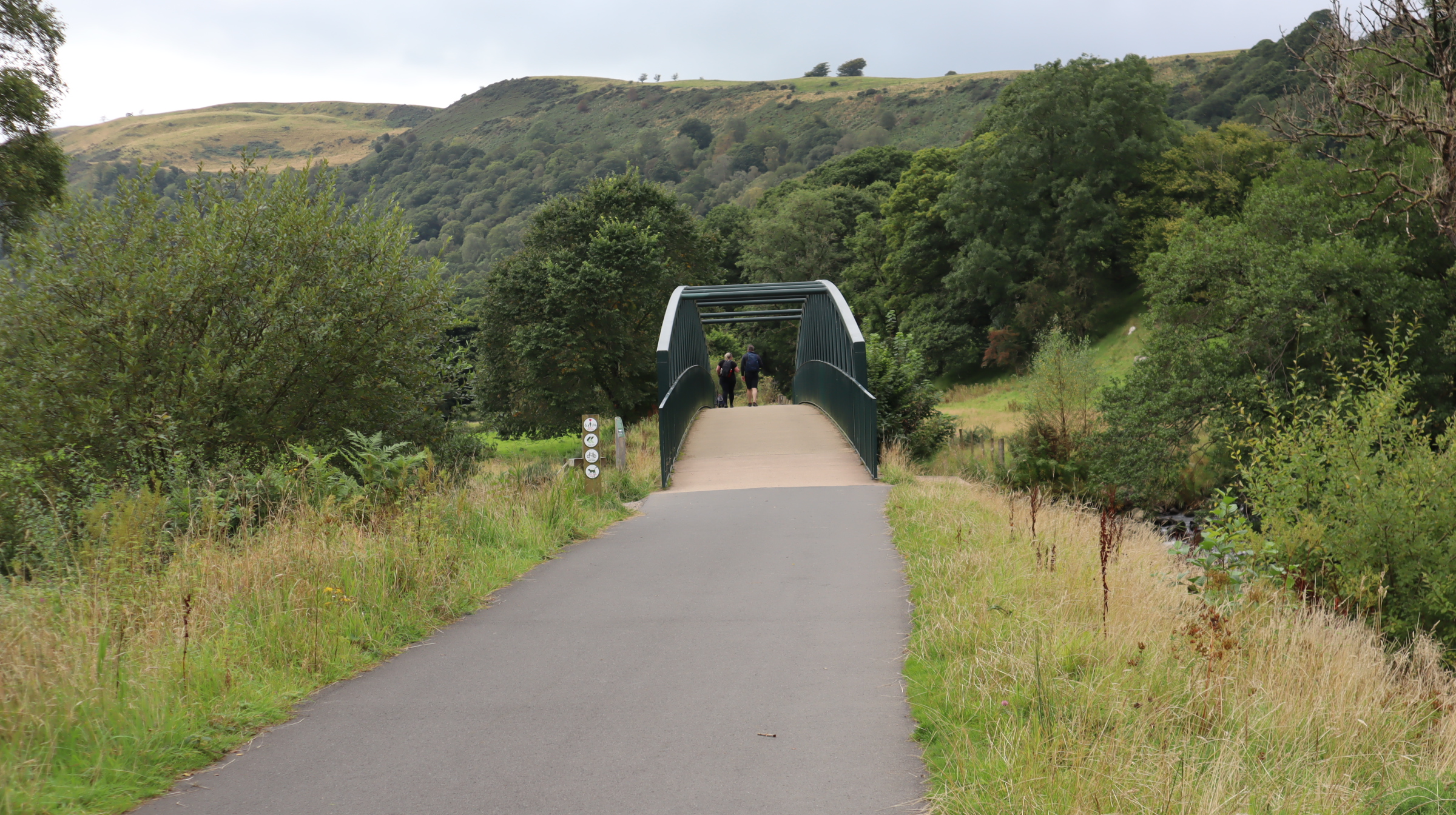
I'm starting from Threlkeld, which I reached via an X4 bus from Keswick. The bus stop is about a quarter of a mile from the start of the path. The path begins by crossing the River Greta for the first time. The railway ran in the Greta Gorge, and crosses the river no fewer than 8 times. The bridges were 'Bowspring Girder Bridges', standing on abutments each side of the river. Whilst the railway was operating, this was a satisfactory arrangement, but, as we shall see later, after closure the bridges suffered damage from the river.

The route then passes through a pleasant woodland environment. Traffic noise from the A66 is replaced by birdsong and the sound of the river, which runs to the right. After the line closed, much of the old trackbed was used as a footpath, with the ballast forming the path's surface. However, when the current path opened at the end of 2020 the route had been re-surfaced throughout using tarmac. Some people complained about this, as they said it should have been left as it was, however, the tarmac surface is easier to maintain, more resistant to flooding, and opened the path up to wheelchair users and leisure cyclists. Walking it is not unpleasant.

Track-side furniture remains along the route, although not being a total railway nut I am never quite sure what it is I am looking at. I would suggest this is a device to hold signal wires, or maybe a tensioner for a telegraph pole. Actually, I have no idea. I'm sure that someone out there in internet land can lend a hand with the identification.

After half a mile or so, the path enters a short cutting. The steep banking on the left is supported by stonework. On the right, there is no need for such support.

A platelayers hut, converted to a shelter. This is actually on the right hand side of the path, but I walked past it to take the shot as a group of young ladies had stopped for a spot of lunch and a gossip, and I didn't think that they would be terribly happy for me to take a picture of them. Generally, the path was quite busy, but I have walked it when it has been deserted. Much depends on the time of year and the weather. There were a lot of children, local I presume, enjoying the last day of the summer holidays.

More track-side furniture, this time a sign saying ½. But half what? Well, actually, I do know this one. About a quarter of a mile further on is another, saying ¼, a quarter of a mile from that one is an old crossing, probably once a road leading to a farm.

The second crossing of the River Greta, followed immediately by a small tunnel. The rock in these parts is fairly hard, and the railway engineers found it easier to tunnel through it than create a cutting.

The aforementioned tunnel, possibly one of the shortest rail tunnels ever built. I wonder if anyone actually knows where the shortest tunnel ever built is. (I don't, by the way!).

Rawsome's Bridge, which at first sight appears to be a different design from the others, however, it is still a Bowstring Bridge, it is just that it is inverted, so the curved 'bow' structure is beneath the trackbed. Why it was made like this is not clear, but it would certainly have improved the views of the river from the train.

View of the river from the bridge. It looks peaceful enough, however, as we'll see, it can be very destructive.

The flanks of Blencathra to the right of the path. Most of the water that falls on that mountain ends up in the river. About a quarter of all the rain that falls on the Helvellyn Range, plus half the rain that falls on the mountains of the central Lake District also ends up in the river, as the catchment includes Thirlmere reservoir. That's a lot of water for one river.

The river has a plentiful supply of brown trout, and this heron knows exactly how to catch them! He was too quick for one unfortunate fish, and also too fast for my camera. Shortly after this shot was taken he'd snatched his prey and was off.
This is Brundholme Bridge, and you'll notice it is not the same design as the others. This is because the original was unseated from it's stone abutments by Storm Desmond. The river was also widened by the storm, so although the bridge was salvaged, it could not be used. A new replacement was made.

Is that an ice cream van on an adjacent road? Should I? After all, it's a warm day. And I read somewhere that ice creams on walking routes have no calories!

A second platelayers hut, again converted to a shelter where weary walkers can polish off their ice creams without being attacked by seagulls!


A little further on from the tree, erosion on the far bank of the river. This was caused by the flooding in 2015, when Storm Desmond wreaked havoc throughout the Lake District. Over 350mm of rain fell in 24 hours on the 5th and 6th December 2015. Now, the yearly average for London is about 560 mm a year, so to get 350 mm in a day is, well, pretty wet! That water had to go somewhere, and a lot of it ended up in the River Greta.

At this point the path runs away from the track bed, which is clearly visible on the right hand side of the river. The track ran on an low embankment, which has been retained in order to prevent the river from washing away the footpath should more flooding occur. ( I say 'should', it undoubtedly will).

After just under a quarter of a mile, the path rejoins the track bed.

White Moss Bridge; again, a new structure since the old bridge was washed away by Storm Desmond.

An information post near to the bridge, showing the damage caused by the storm.

Yet more track-side furniture. But what is it? I suspect it was used to store ballast or something similar, or maybe sand that could be sprinkled on the track during wet periods. I'm sure someone knows the answer, but unfortunately I don't.

Brundholme Road bridge, an inverted Bowstring bridge that survived all storms as the railway is considerably higher than the river at this point.

Yet more erosion caused by the storm, however, nature has a way of bouncing back, and the vegetation is slowly crawling down the slope. I have a photo, taken at this point in 2020, which shows how bad the erosion was.

The previous picture was taken on the left side of the path. This is the scene looking the other way. The river is flowing away from the camera. The holiday park is 'Low Briery' holiday park.

OK track-side furniture experts. What on earth is this? It is made of wood. There are no paths close by, so it is not a footpath sign. It stands on the left hand side of the path.

There are eight river bridges, but road bridges such as this one are a rarity on this line. This is the first one, and heralds the approach to Keswick.

There are some lovely views of the river on this stretch of the walk. This is my favourite, the river to the right of the path, with Latrigg the fell in the background.

We've reached another tunnel, and although the portal is new, the actual tunnel is as old as the railway. It is called Bobbin Mill tunnel, although in the true Cumbrian tradition of understatement, most locals called it the Big Tunnel. Just before the tunnel used to be an old bobbin mill, presumably not called the Big Bobbin Mill! Above the portal is a fence protecting the main A66 road, although what it is protecting it from I have no idea.

Looking back at the tunnel, with the modern road, complete with the Lake District's only flyover. The A66 is dual carriageway at this point. When the railway closed, the tunnel was in-filled and sealed to prevent it from collapse, and also to protect the flyover from damage should a collapse occur. Re-opening it required strengthening work on the embankment, and the removal of 4,000 tonnes of material. The tunnel was also lengthened. Despite it being very rainy in Keswick, no naughty railway engines called Henry were bricked up in the tunnel.

Not only is the trail a footpath, but it is also part of the C2C cycleway, so if you don't want to walk, you can ride it.

The last overbridge. This one carries the main road east out of Keswick.

More track furniture. But again, what is it? Answers on a post card please.

The path runs on an embankment as it enters Keswick. The substantial fence on the right, which has a hedge on the other side, provides privacy for the residents of the nearby houses.

You get two bridges for the price of one here. The main road out of town runs beside the river. The railway crosses both. Back in 1970 I was lucky enough to see a train cross this bridge as we travelled along the road, heading for Grasmere. 21 months later, the railway closed.

The view of the river from the bridge, looking towards Fitz Park and the town centre.

Journey's end, with just one more bridge to cross - a minor road.

The end of the path. The ramp on the left runs up on to the old station platform, while the main path stays on the track bed.


The most boring picture of the walk, in fact, possibly on the whole of the internet. Keswick station had two platforms, but this is all that remains of one of them. It is now an overflow car park for the leisure centre.

The station sign, something many a tourist would have been really happy to see over the years. For the last quarter of a century there has been a campaign to bring the railway back. It has the backing of a number of organisations, including the National Park Authority and local councils. However, any reinstatement is likely to be many years into the future. The National Park Authority have put forward a plan to extend the railway footpath to the old station at Thelkeld, which is a good mile from the village. If approved, the extension could be open within the next couple of years.

And finally.... not
actually on the walk, but certainly of interest to any railway enthusiasts. About half a mile away, in the graveyard of
Crosthwaite Parish church, is a surprising grave. To reach this part of the cemetery, you
actually cross the remains of the old trackbed. Rail enthusiasts of a
certain age will surely remember Bishop Eric Treacy. He was an avid
railway photographer who published a number of books of photographs
showing the railways in the north of England from the 1930's through
to the end of steam. He died in 1978 on Appleby Station whilst
waiting for a rail tour hauled by 'Evening Star', which some said was
a fitting tribute to his life. He left a collection of over 12,000
railway images, which are held at the National Railway Museum, in
York.